Crossing the Rocky Mountains
When the Lewis and Clark expedition came across the Rocky Mountains, they realized that this was going to be one of the most difficult parts of their journey. None of the maps that had been previously created showed any detail and only a single line that looked like mountains.
It looked like you hiked up one side and then hiked down the other side, and that did not represent the true condition of the Rocky Mountains.
It appeared that there were quite a few lines of mountains that the expedition would have to navigate, and each one would take up valuable time.
- The previous April, they had sent some of their men with a keelboat loaded with botanical and zoological samples along with maps, letters, and journals back to St. Louis to be given to President Jefferson.
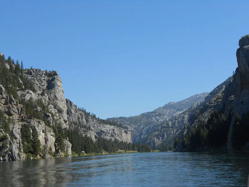
- By July 1805, the men viewed an incredible number of cliffs that were about 1,200 feet high. The cliffs extended out for around three miles and looked like the River had carved a path that was wide enough for them to use to get through the mountains. Lewis named this the “Gates of the Rocky Mountains.”

Gates of the Rocky Mountains - It took the expedition months to continue to what we now call Montana, and it was then that they saw the Great Falls. They had to carry their boats for a number of miles, and it was a long and treacherous journey. When they made it across the Rockies, they came across the Nez Perce people who assisted them with shelter and food. These Native Indians lived along what is today Idaho’s Clearwater River. They spent a lot of time with the Nez Perce but overdid it on eating some of their local foods. Many of the men got sick from overeating, and it took some time for them to recuperate.
- After the Corps began to return to better health, they started building new dugout canoes. They left the horses that they had gotten from the Shoshone people with the Nez Perce and began their journey on the dangerous Clearwater River rapids towards Snake River and the Columbia River. This was the first time since they had left St. Louis that they had the opportunity to go downstream, and it made the traveling pass a lot more quickly.
- By November, the team had been traveling the Columbia River, and once again, Lewis expected to see the view of the Pacific Ocean. Unfortunately, they were instead at the edge of Gray’s Bay, which was inland about twenty miles from the Pacific. This area was an estuary that had strong winds along with incredible waves that stopped their canoes.
- Clark made a note on November 14, saying that it rained all night, and the winds were blowing so hard that they couldn’t tell where they were or where the wind was coming from. Some of the canoes were broken against the rocks as the waves pushed so hard.
- The expedition did get some help from the Clatsop Native Indians that helped them cross the estuary in their larger and sturdier canoes. The weather was now getting colder, and it wouldn’t be long before winter would be there. The expedition had to begin making plans to build another shelter and get food enough to last through the coming cold months. This would be their second winter on the expedition.


